


Voting District UWH, Montgomery County, North Carolina
About
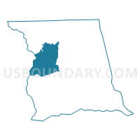
Outline

Summary
| Unique Area Identifier | 640904 |
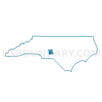
| Name | Voting District UWH |
| County | Montgomery County |
| State | North Carolina |
| Area (square miles) | 42.21 |
| Land Area (square miles) | 41.27 |
| Water Area (square miles) | 0.94 |
| % of Land Area | 97.78 |
| % of Water Area | 2.22 |
| Latitude of the Internal Point | 35.35947300 |
| Longtitude of the Internal Point | -80.02082470 |
Maps

Graphs
Select a template below for downloading or customizing gragh for Voting District UWH, Montgomery County, North Carolina


Neighbors
Neighoring Voting District (by Name) Neighboring Voting District on the Map
- Voting District 0014, Stanly County, NC
- Voting District 0015, Stanly County, NC
- Voting District ELD, Montgomery County, NC
- Voting District OPH, Montgomery County, NC
- Voting District PEE, Montgomery County, NC
- Voting District T1, Montgomery County, NC
- Voting District WAD, Montgomery County, NC
Top 10 Neighboring County Subdivision (by Population) Neighboring County Subdivision on the Map
- North Albemarle township, Stanly County, NC (14,046)
- South Albemarle township, Stanly County, NC (8,225)
- Troy township, Montgomery County, NC (6,270)
- Mount Gilead township, Montgomery County, NC (2,995)
- Eldorado township, Montgomery County, NC (1,873)
- Uwharrie township, Montgomery County, NC (1,825)
- Pee Dee township, Montgomery County, NC (1,434)
- Ophir township, Montgomery County, NC (641)
Top 10 Neighboring Unified School District (by Population) Neighboring Unified School District on the Map
Top 10 Neighboring State Legislative District Lower Chamber (by Population) Neighboring State Legislative District Lower Chamber on the Map
Top 10 Neighboring State Legislative District Upper Chamber (by Population) Neighboring State Legislative District Upper Chamber on the Map
Top 10 Neighboring 111th Congressional District (by Population) Neighboring 111th Congressional District on the Map
Top 10 Neighboring Census Tract (by Population) Neighboring Census Tract on the Map
- Census Tract 9602, Montgomery County, NC (7,370)
- Census Tract 9310, Stanly County, NC (5,806)
- Census Tract 9302, Stanly County, NC (4,446)
- Census Tract 9603, Montgomery County, NC (3,914)
- Census Tract 9604.02, Montgomery County, NC (2,306)